The most important tasks of IMGW-PIB include monitoring of physical processes in the atmosphere and hydrosphere, as well as forecasting and early warning against natural phenomena and disasters.These activities are primarily aimed at protecting society and the economy from severe losses.However, since the IMGM-PIB does not have the competence to manage crisis operations in the field, close cooperation with the relevant local and governmental bodies is necessary. In this regard, very good solutions have been implemented in the Małopolskie Voivodeship.
AUTHORS:
Małgorzata Maczuga, IMGW-PIB
Rafał Stepnowski, IMGW-PIB
Crisis management is a type of activity of public administration bodies aimed at managing national security. The main objective is to prevent critical situations, take control over them through planned actions, respond in the event of emergencies, remove their effects, and restore resources and critical infrastructure. These activities are implemented to a different extent by government administration agencies and local authorities at the voivodeship, district, and commune levels. Support from IMGW-PIB is mainly directed to voivodship authorities, although it also happens that the Institute supports activities in districts and communes.
The cooperation of IMGW-PIB with voivodeship crisis management centers is determined by the Ordinance of the Minister of Maritime Economy and Inland Navigation of June 28, 2019, on warnings, forecasts, communications, newsletters, and yearbooks of the national hydrological and meteorological service, and the national hydrogeological service. This document, among others, lists the products that the Institute is obliged to submit to the managing authorities within a specified period.
There are established units at IMGW-PIB responsible for supporting relevant state entities in the field of risks arising from the current hydrological situation. The Central Office of Operational Hydrology in Warsaw maintains contact with crisis management authorities at the national level (including the Government Security Center). Whereas at the voivodeship level, there are Hydrological Forecasts and Studies Offices present.

Mode of cooperation
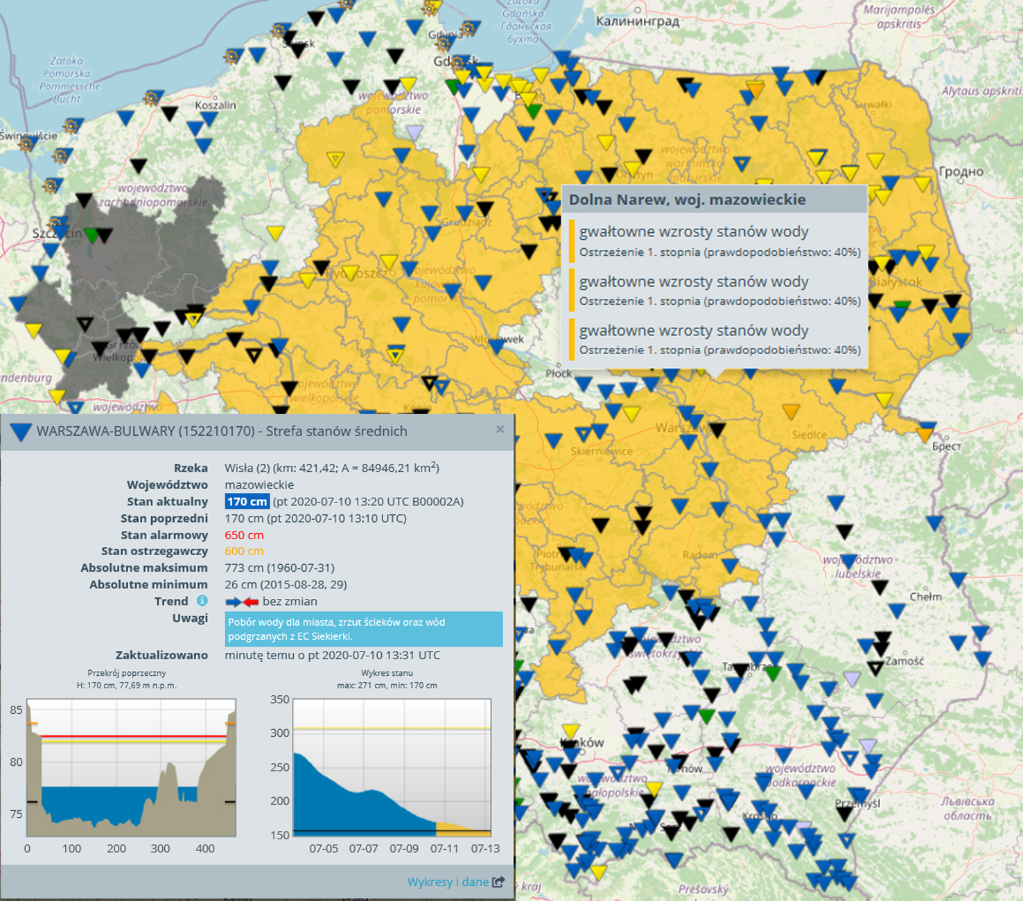
The scope of information and the method of communication depends on the current situation. If there is no hydrological risk in a given region, voivodship crisis management centers receive daily standard updates on hydrological conditions from IMGW-PIB. These are, among others: reports on water states in rivers, average and maximum precipitation for the last 24 hours (broken down by catchment area), as well as a hydrological bulletin containing very detailed hydro and meteorological data. A significantly extended set of data is provided to crisis teams during a hydrological emergency.
Information on a Hazardous Phenomenon/Hydrological Warning
These are issued to individual catchments and sent via e-mail and through the Customer Service System (SOK). They identify the hydrological hazard: i) information on a hazardous phenomenon, level 1 – sudden increases in water levels; ii) information on a hazardous phenomenon, level 2 – exceeding the warning states; iii) hydrological warning, level 3 – exceedance of alert states; iv) warning of hydrological drought.
Flood message
If in the profile controlled by the IMGW-PIB, the warning state is exceeded, the Voivodeship Crisis Management Center on which the profile and the river are located, receives flood warning messages on the current water level every 6 hours. After exceeding the state of emergency, the information is sent every 3 hours.
Hydrological message
It is compiled daily at 18:00 UTC if the hydrological phenomena are increasing in strength and dynamics. This message includes: an up-to-date current description of the hydrological situation, a list of stations where the warning levels have been exceeded, with information on the value of these exceedances, and an up-to-date hydrological forecast for the entire shielded area.
E-mail and telephone contact
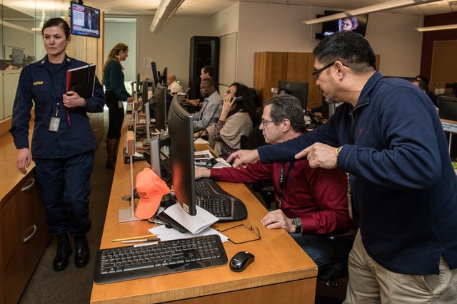
Since the Hydrological Forecasts and Studies Offices are operational, i.e., in an emergency, they perform 24/7 flood duty, monitoring hydrological situation’s development. Constant communication via e-mail and telephone is maintained with the Voivodeship Crisis Management Centers.
Water stage forecast
When the warning and then alarm states are exceeded on the basic and additional water gauge profiles, the Institute prepares a detailed forecast for the next couple of days, which indicates the expected water state for these profiles at 06 00 UTC (depending on the profile, this is a 1, 2 or 3-day forecast). This forecast is updated every 6 or 3 hours.

Flood crest forecast
When a flood wave arises on the river, the Institute draws up a detailed forecast, which determines the flood crest and the time at which this maximum occurs (including the type of exceedance – warning/emergency state). For so-called additional profiles², the wave forecast is updated every 6 hours and even more frequently in the case of significant changes.
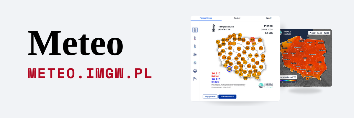
IMGW-PIB Monitor
Each Voivodship Crisis Management Center also has permanent access to current hydrological data, numerical synoptic forecasts, and forecasts from the hydrodynamic model (HD) for selected profiles, updated and published on the specialized website IMGW-PIB.
The daily hydrological bulletin of the IMGW-PIB submitted to Voivodeship Crisis Management Centers contains:
• a simplified description of the meteorological situation for the previous 24 hours, including a table containing the precipitation value range on the catchment area (min-max) and the name of the station with the highest recorded precipitation in the given catchment area;
• snow cover height and the value of freshly fallen snow at a given observation station (in winter);
• ice phenomena observed in selected profiles (in winter);
• description of the hydrological situation after the last 24 hours, including a table containing the water states increases after the last 24 hours (between 6.00 UTC on the current day and 6.00 UTC of the previous day);
• zones of levels in which rivers are arranged at 6UTC;
• a table with stations at which, at 6 UTC, the warning/alarm state was exceeded and information on how much the warning/alarm state was exceeded;
• map with water level zones on rivers on a given day at 6 UTC;
• a table containing stations where the flow from 6 UTC recorded SNQ values;
• hydrological forecast for the protected area from 6 UTC of the current day until 12 UTC on the following day;
• information on anticipated threats (in practice issued, warnings/ information on a hazardous phenomenon.
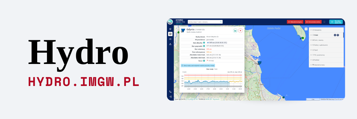
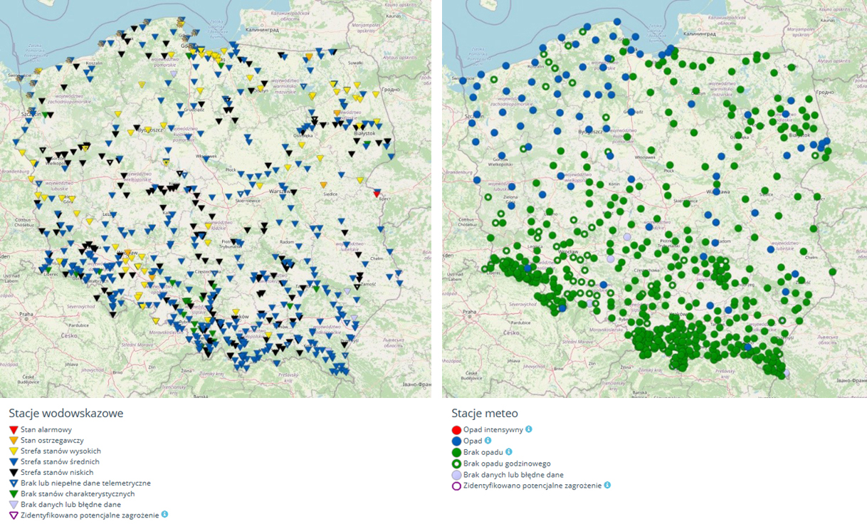
Monitor IMGW Service – a tool for local authorities
Each of the Crisis Management Centers has access to the full version of the IMGW Monitor. What is this application, and what are the possibilities? The Monitor is the only such advanced and complete tool in Poland to monitor the atmosphere and hydrosphere in real-time. It enables the presentation and visualization of data and products prepared at IMGW-PIB without the need to process the data beforehand. Thanks to direct connection with hydro and meteo databases, Monitor users can access the latest precipitation, water levels, and extreme phenomena in Poland.
The application was created with the use of web technology. It does not require installing additional software and can be run from any device connected to the global computer network. As a result, the products and functionalities of the Monitor are available not only to IMGW-PIB employees but also to statutory working users, among others, in anti-crisis headquarters (emergency centers), regional water management boards, or voivodeship offices.
The service is customized to work in an operational mode. The possibility of visualizing threats in charts and maps has been introduced, which are being updated with new data flows. In the event of an emergency, the frequency and scope of the stations for which forecasts are issued are increased to facilitate the relevant services’ work to protect people and property. We wrote about the IMGW Monitor service in detail in the July issue of Observer https://obserwator.imgw.pl/monitor-aplikacja-wspierajaca-instytucje-zarzadzania-kryzysowego/.
Activity of IMGW-PIB in Małopolska
In the voivodships of southern Poland (Śląskie, Małopolskie, Świętokrzyskie, Podkarpackie, and Lubelskie voivodeships), the unit responsible for supporting Crisis Management Centers is the Hydrological Forecasts and Studies Office, operating at the IMGW-PIB office in Krakow. In addition to the usual activities described previously, the Krakow team carries out many additional tasks. It results from many years of cooperation with the local authority and the specificity of the Małopolskie Voivodeship, where the risk of floods (due to the mountainous nature of rivers) is much greater than in other regions of Poland. Thanks to both parties’ commitment, it was possible to build an efficient communication and support system in which the employees of IMGW-PIB play an expert and advisory role.
The basis of this cooperation are cyclical, run every Friday, teleconferences which involve the employees of the Malopolska Crisis Management Center and forecasters from IMGW-PIB – a hydrologist from the Hydrological Forecasts and Studies Office, and a meteorologist from the Meteorological Forecasts Office. During the meeting, a two-day weather forecast for the Małopolskie Voivodeship and a hydro forecast for selected rivers, are regularly presented. If there is a risk of hazardous phenomena, the action plan for the voivodeship is also discussed. Unfortunately, due to the COVID-19 pandemic, teleconferences have been suspended.
The second element of cooperation between the IMGW-PIB and the Małopolska local government is the mutual exchange of knowledge and experience. The Hydrological Forecasts and Studies Office in Krakow organizes training sessions for the Voivodeship Crisis Management Center employees, during which strictly hydrological issues are discussed, the improved principles of operation, and procedures of contacts between units. In turn, future hydro-forecasters from IMGW-PIB do an internship at VCMC, where they learn about the specifics of the job and are able to establish good working relationships with the employees of the center. Meetings are also held at the management level. They discuss the principles of cooperation, search for new solutions and improve communication procedures.
Several times a year, the regular meetings of so-called Crisis Management Teams are held at venues throughout Poland. Meetings are convened by provincial governors. The teams consist of all voivodeship services representatives, including the Police Headquarters, State Fire Service Headquarters, Building Supervision Inspectorate, Road Transport Inspectorate, or sanitary and epidemiological stations. By the decision of Małopolska Voivode, a representative from the IMGW-PIB, also actively participates in the Crisis Management Team meetings. He is also present during crisis teams, convened in the period of flood risk. Thanks to this, team members can regularly consult current meteorological and hydrological forecasts and data from the Institute’s measurement and observation network.

The cooperation between the IMGW-PIB and governmental and local bodies has been strengthening in recent years. It is the cooperation based on trust and many years of experience, which significantly improves the quality of work for experts as well as for representatives of local and government authorities – who repeatedly have to make difficult decisions on society’s safety. Cooperation in the Małopolskie Voivodeship represents a model example of a relationship that is not solely based on the formal sender-receiver relationship. The readiness of the experts in the field of hydrology and meteorology to contact directly, as well as the availability to use the latest IMGW-PIB applications, is highly valued and utilized. As a result, the Institute begins to be perceived not only through the prism of science but also as an equal partner for other emergency services. You can build profitable, lasting cooperation because we care about a common vision and aims. We pay attention to reaching the full potential of all members across both teams, we care of trust for all members of both teams, good working relations, efficient communication, and a sense of shared responsibility, which is to protect people and property against threats from the forces of nature.
Main photo: Ijon Tichy | Unsplash