In the cold season, thunderstorms are an exceptional phenomenon. However, there are weather conditions so dynamic that they favor the evolution of well-developed Cumulonimbus clouds and the occurrence of atmospheric discharges also in winter. Such conditions occurred in Poland on March 26, 2019, when the active low and the cold front were moving fast through the eastern voivodeships. Strong wind gusts, heavy snowfall and numerous atmospheric discharges were a real danger. They paralyzed in many places traffic on the roads, among others. The analyzes of the radar and measurement data of the IMGW-PIB show how rapid and sudden the development of these phenomena was.
AUTHOR: Janusz Zieliński, IMGW-PIB, National Meteorological Protection Centre
In winter, as in summer or spring, Cumulonimbus clouds develop under conditions of thermodynamic instability and a steep lapse rate, i.e., a rapid temperature drop with the height. In the colder months, such circumstances occur most frequently on active cold fronts, followed by cold air. If lightings are accompanied by heavy snowfall, it is a snowstorm.
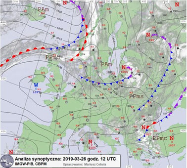
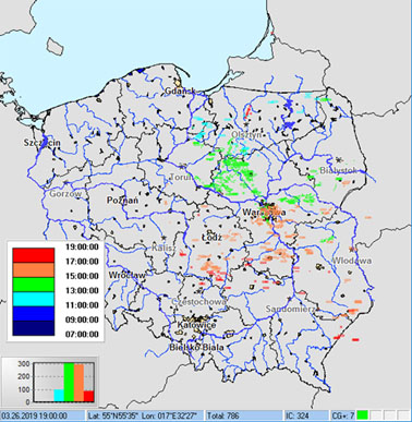
the blue colour indicates the cold atmospheric front over northern Poland.
A cold atmospheric front entered Poland from the North in the afternoon on March 26, 2019. The development of deep convection was also supported by the conditions prevailing in the higher layers of the atmosphere, where an active trough of low pressure expanded. It deepened as the front moved over central Poland, which led to air suction from low to high and the formation of storm clouds. In addition, a jet stream formed in the troposphere, which contributed to the intensification of the phenomena.
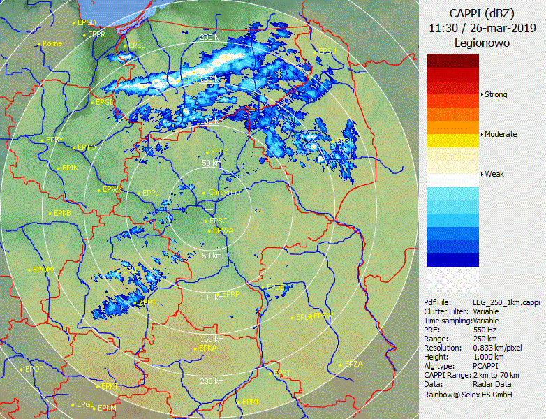
The events on the front intensified, forming a linear convective system (a squall line) over time with numerous discharges and gusts of wind up to 25 m/s (90 km/h).
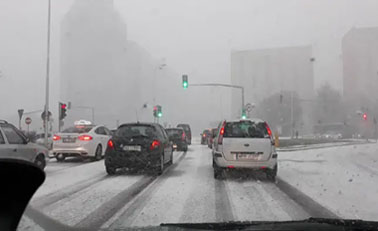
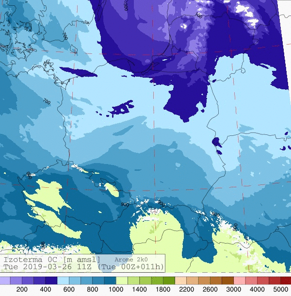
As the front traveled, there was advection (inflow) of cold, arctic air accompanied by the rapid decrease of the isotherm 0°C (in many places below 300 m above sea level), which led to snowfall. At places, especially in Mazovia and the Lublin Region, rainfall was intense. It caused enormous road traffic obstacles. According to the Government Security Centre, 222 interventions related to the removal of the effects of strong wind were recorded (most in Mazovia – 57, Lublin Region – 27, and Silesia – 23). As a result six people died in four road accidents.
In Poland, there are several days during which Cumulonimbus clouds reach dimensions that allow for the generation of single lightings, especially in the coastal area almost every winter. In recent years, the strongest snowstorms in our country occurred in December 2013 and were associated with a deep and active Ksawery low. Similar phenomena also appear occasionally in other parts of Europe, Asia, and North America. They cause major difficulties, e.g., in urban traffic, and contribute to severe losses in the energy infrastructure. It shows that snowstorms are an element of the weather that is difficult to forecast.
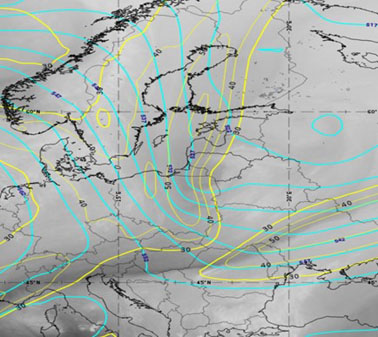
and the intensification of precipitation during its passage through north-eastern Poland.
The strong advection of arctic air caused snowstorms in many parts of eastern Poland.
Main photo: Andre Furtado | Unsplash