The first meteorological radar was launched in Poland nearly 60 years ago. The radar network, covering almost the entire country, has been in operation for about two decades. Compared to other measurement methods, radar meteorology is a new field of atmospheric research. Nevertheless, it is developing rapidly. Over the years, the technical capabilities of the radars have improved significantly, and the data obtained is of increasingly better quality. We are just entering the stage of further changes related to the modernization of the POLRAD network.
AUTHOR: Sylwia Śmigiera, IMGW-PIB/Hydrological and Meteorological Measurement and Observation Network Centre, Ground Based Remote Sensing Department
Radars are a valuable source of information about the weather here and now. We can use them to track the development and movement of precipitation and determine wind speed or hail size. We apply the data obtained from radars in meteorological and hydrological models, to prepare forecasts and issue warnings. These devices also play a huge role in aviation protection. Importantly, information from radar measurements is available to every resident of Poland, so you can check what is happening in your area at any time – whether a storm or heavy rainfall is coming.
Radars’ correct operation is supervised by the Ground Based Remote Sensing Department (WTN) employees – radar operators, service technicians, and the data analysis group. They monitor the operation of radars and check whether the correct products are generated. Their tasks also include the maintenance of equipment and carrying out routine inspections. In addition, WTN is involved in analyzing and interpreting the received data, correcting radar settings and product parameters, and searching for new solutions. Thanks to the team’s work, the radar data provided by IMGW-PIB is of such high quality.
Radar meteorology in Poland
The first DECCA and MRŁ radars, installed in the 1960s, differed significantly from the modern ones. The images they displayed were redrawn on paper, and notes prepared in this way were sent to recipients, which took tens of minutes. Therefore, the information was delivered with a considerable delay by today’s standards, and its usefulness was questioned. Interestingly, the DECCA radar only worked when precipitation was expected. Since its antenna was not covered by a radome, local residents knew of coming rain as soon as the device began to spin.
At the beginning of the 21st century, there was a rapid development of radar meteorology in Poland. It was, of course, related to the construction of the POLRAD network consisting of 8 radars, which was put into operational work in 2004. Its modernization was carried out from 2009 to 2015. At that time, the radars in Pastewnik, on Ramża hill, and in Rzeszów were replaced with dual-polarization devices. This significantly increased the measurement capabilities and the number of recorded parameters. More advanced products were developed, and the quality of data improved significantly.
Network modernization – where will new radars be established and why?
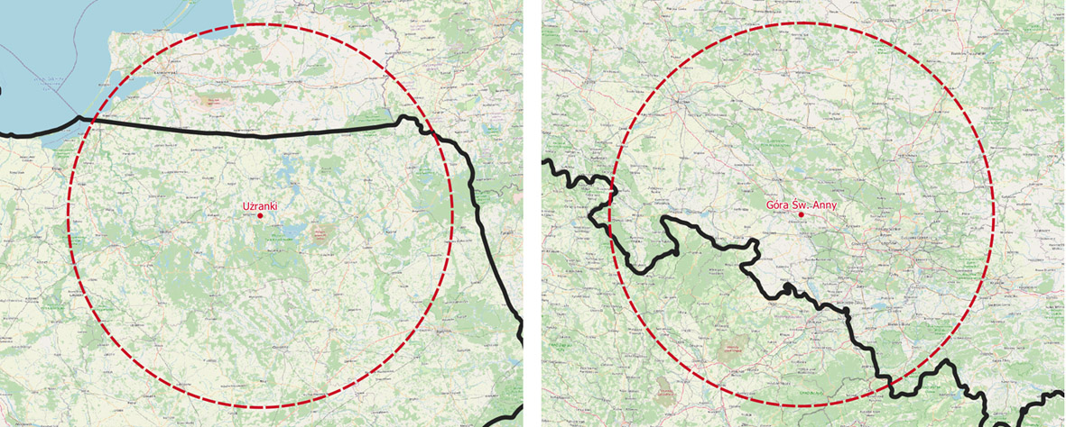
Currently, the POLRAD network consists of Doppler C-band (about 5.5 GHz) radars. By the end of 2023, the entire system will be modernized and expanded. On 16 May 2022, the radar in Legionowo was shutdown. In the coming months, all equipment will be replaced by devices with magnetron with dual-polarization measurement functionality. Two new radar stations will also be built – In Użranki and on St. Anne’s Mountain. In addition, it is planned to increase the height of the radar tower in Brzuchania, which will improve the quality of the collected data, and move the radar in Gdańsk by several kilometers to the north-west (which will result in a change of its name) to enable the expansion of the airport.
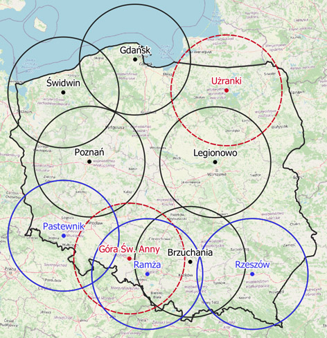
The planned investments are another milestone for Polish radar meteorology. Measurement capabilities will increase, and data quality will improve. It will be possible to measure additional parameters and generate more products. The coverage of Poland with radar data will also increase significantly, mainly due to the facility’s construction in Użranki near Mrągowo. Until now, the north-eastern part of the country has been monitored only by the radar in Legionowo. Because of the considerable distance, this radar could not detect all meteorological phenomena, especially in the lower atmosphere. Besides, during service work or failure of the device in Legionowo, a large part of Poland was completely devoid of radar data. The investment in Użranki is significant for tourism as it will improve the safety of Masurian lakes.
The second of the new radars will be built on St. Anne’s Mountain, in a place seemingly well monitored by other devices. However, if we take into account the topography and the specificity of radar measurements, it becomes clear that not all areas in the south of the country are properly registered. Thus the construction of another radar in this area is justified. It will be located between two large mountain ranges – the Carpathians and the Sudetes where there are favorable conditions for developing dangerous phenomena. Situating the radar right here will allow for early warning of hazards and improve safety.
New measurements capabilities
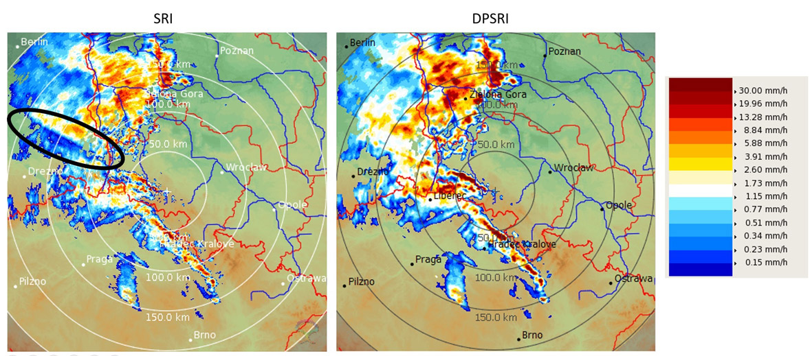
A classic radar sends a beam of electromagnetic wave polarized horizontally. It means that the electric component of this wave oscillates in the horizontal plane, and measurements are only made in this plane. Dual-polarization radars (dual-pol), which will ultimately operate in the entire POLRAD network, simultaneously emit a vertically polarized beam. This allows them to „see” in both planes. It is also possible to determine additional parameters by juxtaposing the signals from both wave polarizations. The basic parameters obtained from measurements with dual-pol radars are: differential reflectivity (ZDR), differential phase shift (PhiDP), specific differential phase shift (KDP), and cross-correlation coefficient (RhoHV). This information makes it possible to identify the type of precipitation by determining the physical properties of hydrometeors. Dual-polarization also allows for correcting the attenuation of the electromagnetic wave in zones of heavy rainfall, improving the accuracy of estimating the intensity of precipitation (and its totals) and determining the hail size.
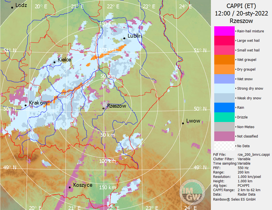
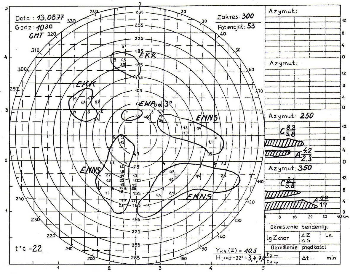
The POLRAD system uses two algorithms for recognizing the type of precipitation – BMRC and NEXRAD. On the map, the BMRC algorithm correctly detected the areas of occurrence of different precipitation types. The areas marked with shades of gray indicate strong dry snow and weak dry snow. Orange colour marks the areas of occurrence of dry graupel.
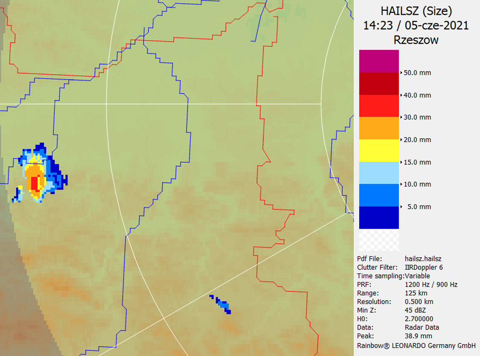
HAILSZ product (hail size) determined from radar data in Rzeszów on 5 June 2021, at 14:23 UTC. The size of hail generated by the supercell thunderstorm near Bochnia was correctly estimated, which was confirmed by ground observations.
The coming months are a period of intense work, requiring the involvement of many IMGW-PIB employees. Above all, the WTN team will have to familiarize themselves with the new technology and its capabilities. During the shutdown of individual devices, the scanning strategies of other radars will be changed to compensate to some extent for the lack of data. However, the result is worth sacrificing – IMGW will soon have the most modern radar network and new measurement possibilities. The public will have more accurate and richer weather information.
Currently, information on the modernization, shutdown, or installation of new radars will be posted on the Institute’s website, on the IMGW-PIB social media, and on the website https://pl.wikipedia.org/wiki/POLRAD.
The study uses materials from Irena Tuszyńska’s book „Rozwój meteorologii radarowej w Polsce”.
Author: Sylwia Śmigiera | Hydrological and Meteorological Measurement and Observation Network Centre, IMGW-PIB.
Main photo: Daniele Franchi | Unsplash.